Introducing Sitehound Mapping & GIS: A New Way to Track

You’ve probably heard about Sitehound’s powerful asset tracking and management features. Did you know we’ve built out our mapping capabilities? You can track multiple projects across an entire business location and map updates occur automatically. Get the inside scoop on Sitehound GIS and what it can do for your business in this post!
What is Sitehound GIS?
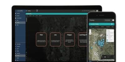
Sitehound Mapping & GIS is the newest addition to the Sitehound Tracking & Management Software package. Sitehound GIS offers users the ability to track, detect distribution problems, and implement geofencing. It is a cloud-based system for viewing, measuring, and monitoring one’s business processes.
Sitehound provides geolocation tracking, live updates, and maps to show project progress. These features allow users to see the status of their projects as they work, as well as movements or changes over time.
- Our user interface is highly intuitive and easy to use.
- Our software is constantly updated with the latest features and advances in tracking technology.
- Our team of experts are always available to answer any questions you may have.
- We offer a free trial so that you can test out our service before committing to it.
- Our prices are competitive, and we offer discounts for bulk subscriptions.
Why Choose Sitehound Mapping & GIS?
There are many reasons to choose Sitehound GIS as your go-to source for tracking data. Here are just a few:
- Collect real-time points from devices in the field – Employees, Vehicles, etc. and overlay onto locations to track progress, movement, and more.
- Compare session tracking data on the web to allow insight into trends over time.
- Export your data out of Sitehound for import into ArcGIS or other 3rd Party GIS systems.
- Import data from ArcGIS into Sitehound.
- Maps & Geofencing work in offline mode.
- Have a more customized use case, let’s talk.
Advantages of Sitehound Mapping & GIS vs ArcGIS Collector
Sitehound Mapping & GIS streamlines project management for geo-spatial projects. You can now see the total cost and make sure that it is within a budget before starting work on the project.
- Collect points from devices (mobile phone, tablet, IOT, or vehicle) in the field at configurable intervals to track movement over time.
- Create Points of Interest (POI) from your mobile device and collect data points about them. This can all be done Online or Offline and uploaded later via a batch transaction.
- Configure defaults to customize your experience: units of length, distance, area, etc.
- Choose one of our existing tilesets provided by MapTiler or bring your own Tile Provider.
- With Sitehound you can still track and manage assets and inventory while utilizing Sitehound GIS for your geo-spatial projects.
Learn more!
So, whether you’re trying to figure out where your inventory shipment is or trying to track the spread of a disease, Sitehound can help. Sitehound GIS is a powerful mapping tool that helps you quickly track and visualize data, making it easy to see patterns or trends that would be difficult with traditional methods. With Sitehound GIS create virtual boundaries that trigger a response whenever a mobile device enters or leaves a location. With geofencing, you can use this feature to activate audiences while they are in a particular space, driving website and in-store visits or protecting employees from entering off-limits or dangerous areas of your facility.
To find more on how Sitehound Mapping & GIS can help you.