Embark on a journey towards unparalleled efficiency with our software's Mapping and GIS feature. It's like having a GPS for your assets – combining pinpoint accuracy with an expansive overview. Say goodbye to guessing games and treasure hunts. With real-time mapping, you can effortlessly track and manage your assets with the precision of a cartographer and the strategic insight of a mastermind. Whether you're plotting inventory locations or planning asset routes, this feature transforms complex data into captivating visual masterpieces, ensuring you never get 'lost in the woods' during your asset management journey.
What we do ?
Sitehound Mapping & GIS: Create. Collect. Track. Analyze.
Whether you're seeking the whereabouts of your inventory shipment or aiming to monitor the spread of a disease, Sitehound is here to assist you. With over two decades of dedicated research and continuous refinement, we are well-equipped to meet your needs. Tailored with your convenience in mind, Sitehound empowers you to effortlessly track not only your assets but also your time, employees, and real-time data – both online and offline. Unleash the power of your data today with Sitehound.
Now There's An Alternative
With the deprecation of the ArcGIS Collector app on Android and iOS on December 31, 2021, there was a void in functionality for many users. However, we are excited to introduce Mapping & GIS, the latest addition to the Sitehound Tracking & Management Software package. This powerful tool empowers users to track, identify distribution issues, and implement geofencing. Utilizing a cloud-based system, Mapping & GIS offers a comprehensive solution for visualizing, measuring, and monitoring business processes.
Anticipating every possible issue your business may encounter is an impossible task. Without a geolocation tracking solution that provides real-time, actionable data, you're essentially operating at a disadvantage. It's like trying to make decisions with one hand tied behind your back. This inevitably leads to subpar decision-making, unnecessary expenses, inefficient workflows, decreased productivity, and ultimately, underwhelming revenue.
HOW IT WORKS
Mapping &
GIS In-Action
Whether you are a city planner, a business owner, or an environmental scientist, GIS can help you make better decisions and solve complex problems. Sitehound GIS Tracking software is a sophisticated technology that combines GPS data with advanced mapping capabilities to provide real-time location tracking of assets, vehicles or personnel. This powerful tool allows organizations to monitor their resources, streamline operations and improve overall efficiency.

Create.
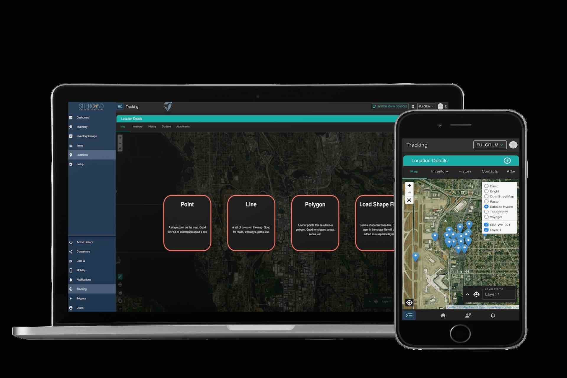
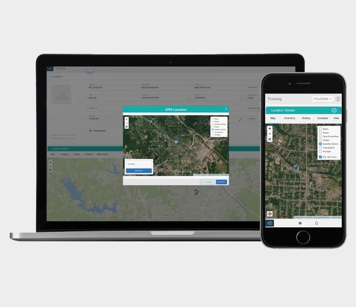
Start by selecting a pre-existing tileset from MapTiler or bring your own Tile Provider. Create map layers by importing ShapeFiles or geojson objects, or start from scratch. Customize your map with boundaries, points, lines, or polygons for online and offline use. Configure defaults like units of length, distance, and area. Use our session manager to test and refine your maps and collection rules.

Collect.
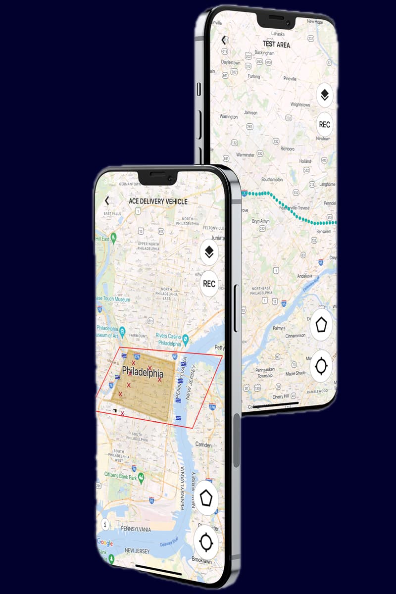
Utilize online or offline maps and geofencing to begin data collection. Gather real-time points from field devices such as employees and vehicles, and overlay them onto specific locations. Create Points of Interest (POI) using your mobile device and collect relevant data points about them. This entire process can be done both online and offline, with the option to upload the data later through a batch transaction.

Track.
Monitor your progress, movement, and more with our comprehensive tracking system. Gather points as you go, gradually accumulating them based on the frequency you set in the app settings. You can adjust the points by specifying the desired number of seconds between each increment, measured in convenient one-second intervals. Stay motivated and achieve your goals with our advanced monitoring features!
Analyze
By comparing session tracking data on the web, you can gain valuable insights into trends over time. Easily export your data from Sitehound to ArcGIS or other systems, or import data from ArcGIS into Sitehound. Leverage Sitehound's internal data analysis tools to efficiently manipulate, quantify, and manage your data with ease, ensuring optimal results or export data to a 3rd party mapping tool like ArcGIS.
HOW IT WORKS
Taking Asset Management to the Extreme: How Sitehound Software with GIS Tracking Help Off-Road Recovery Teams Navigate the Wild
Our Education Center
Industry Best Practices
Harnessing the Power of Software in Managing Tangible and Intangible Assets
By Heather GeerFebruary 5, 2024

Optimizing Operations: The Crucial Importance of Tracking Inventory and Assets Across Multiple Warehouses
By Carlos MaldonadoJanuary 15, 2024

How to Implement Inventory Management Software for The First Time
By T. Nick WilliamsNovember 7, 2023